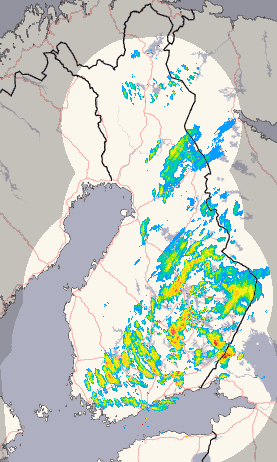
Assessing both the accuracy of rainfall products and quantifying uncertainties due to specific algorithm components requires a combination of in situ measurements of profiles of cloud and precipitation microphysics and associated surface rainfall observations. LPVEx will, therefore, consist of coordinated aircraft flights within an extensive network of ground-based observations that includes three dual-polarization, C-band, Doppler radars, a network of surface weather and sounding stations, several micro-rain radars, and surface rainfall and drop size distribution (DSD) measurements from a large number of raingauges and disdrometers. The core analysis strategy for the experiment is based on an "algorithm-simulator" approach where well-calibrated, multi-frequency, polarimetric radar observations are used to extend in situ measurements of the vertical/spatial distributions of temperature, humidity, aerosol concentrations, cloud water concentration, rain drop size spectra, particle phase, and surface rainfall intensity to full three-dimensional volume depictions of rainfall scenes. When combined with appropriate satellite simulators, these 3D volumes can be used to characterize the detection characteristics and evaluate algorithm performance for all current rainfall platforms including PMW imagers and sounders and the CloudSat CPR and assist in the development of the next generation of satellite rainfall retrieval algorithms for GPM GMI and DPR instruments. In this way, the combination of C-band radar reflectivity measurements and coincident in situ and ground-based microphysics measurements can be used to isolate the effects of a wide variety of algorithm assumptions including the assumed drop size distribution, relative amounts of cloud and rain water, mixed-phase and ice scattering properties, and vertical and horizontal variations in the cloud and rain field. CloudSat's precipitation algorithms will also be evaluated using measurements of reflectivity from the airborne equivalent to the Cloud Profiling Radar (CPR). These observations will be used as input to CloudSat's precipitation algorithms allowing the physical models relating cloud and precipitation microphysics to reflectivity, attenuation, and multiple-scattering to be tested and providing direct evaluation of algorithm performance against measured in situ microphysical information.


